Check out our 2024 Retrospective for a look back at events that shaped the wiki during 2024.
Oblivion:Maps
The UESPWiki – Your source for The Elder Scrolls since 1995
< Oblivion(Redirected from Shivering:Maps)
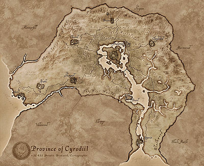
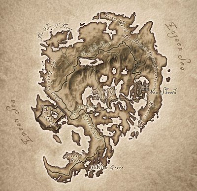
This page provides information on various maps available for The Elder Scrolls IV: Oblivion and The Elder Scrolls IV: Shivering Isles. Local and interior maps with further zoom and higher detail can be found on the articles for each location in the game.
Contents
General Maps[edit]
- Oblivion Satellite Map — UESP's own high resolution Cyrodiil map.
- Shivering Isles Satellite Map — UESP's own high resolution Shivering Isles map.
- Tamriel Maps: Cyrodiil
- Tamriel Maps: Shivering Isles
- Colorized map of Cyrodiil
- Labeled map of Cyrodiil
- Interactive map of Shivering Isles
- Colorized and labeled map of the Shivering Isles
Specific Maps[edit]
- Daedric Shrines — A map showing the locations of all Daedric Shrines
- Wayshrines of the Nine — A map showing the locations of all Wayshrines
- Oblivion Gates — A map showing the locations of all 100 possible Oblivion Gates
- Exterior Creatures — A map showing where creatures encountered outdoors can be found
- Cyrodiil roadmap — A map showing back roads as well as the major routes.
- Shivering Isles Region Map — A map denoting the separate regions of the Shivering Isles: Mania and Dementia
Icons[edit]
These are the icons used on the in-game map.
On the compass and map, dark brown locations are places you have previously visited (and therefore may fast travel to), and those in light brown are undiscovered. Icons are not displayed on the map unless you have either discovered them or they have been marked for you on the map.
|
| ||||||||||||||||||||||||||
See Also[edit]
- Unmarked Roads—Information about roads that are not marked on the in-game map.


